Last Updated on July 3, 2026 by Matthew Hallock
Decades ago, a classic Chiffon Margarine commercial warned us that “It’s not nice to fool Mother Nature.” Today, her message has evolved from a clever ad into an existential warning: The trashing of the planet must end, or it will be our end. To that end, the promising and powerful CT Environmental Rights Amendment (CTERA) or Green Amendment, places a priority on saving the earth over moving it to build.
This state constitutional amendment threatens to open the golden capitol dome in Hartford, exposing a deep system of public sector misinformation and corporate self-interest that directly threatens Connecticut’s coastal towns. Audits reveal that out-of-town actors have replaced key Fairfield documents with fabricated or obsolete maps with invented neighborhoods. In the case of Fairfield’s official Master Plan and Open Space Maps, they simply shelved them for new maps of their own creation.
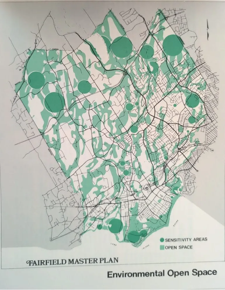
This is the official Fairifeld Open Space map from the 1979 (printed 1980) Master Plan
The goal, from the start, is to fast-track high-density urbanization by minimizing the impact of climate change and environmental risk. Currently, developers are attempting to fool Mother Nature by utilizing obsolete municipal records to fast-track high-density rental projects directly on top of protected wetlands. In Fairfield alone, developers are relying on a dangerously outdated 2013 FEMA study. It clearly shows virtually all of the Beach area, Downtown, most of the seven miles of Route 1 through town, and the Black Rock Harbor at the RR station already within flood zones or at high risk. And this is before 12 consecutive years of rising global temperatures and sea levels.
As one example, iconic Black Rock Harbor and the large, historic downtown of Tunxis are officially erased on vendor maps for the synthetic Commerce Drive high-density TOD.
The climate reality is already altering the marketplace; private insurance companies are pulling coverage from flood zones entirely, yet local zoning boards ignore these facts to enable urbanization.
The Legislative Reality: S.J. 37 and the Green Amendment
Emerging quietly amid the din of housing legislation this past session in Hartford was the passing in committee of Senate Joint Resolution 37 (S.J. 37). This landmark resolution proposes adding a simple, unassailable safeguard to the State Constitution’s Bill of Rights:
“Each person shall have an individual right to clean and healthy air, water, soil and ecosystems, a clean and healthy environment and a safe and stable climate for the benefit of public health, safety and the general welfare.” It goes to the full floor this fall.
In plain terms, it establishes a legal mandate that an individual’s right to a clean, safe planet takes precedence over corporate building developments. Furthermore, it introduces a historic first: municipalities that fail to comply become legally liable. Because this amendment grants everyday property owners immediate legal standing to hold local zoning boards and developers accountable, corporate builder lobbies are fighting aggressively to kill it.
The Stakes of S.J. 37
By passing S.J. 37, citizens strip away the “plausible deniability” used by developer cartels. The following table illustrates the stakes of this legislative battle:
| Feature | The Corporate Playbook | The Green Amendment
|
|---|---|---|
| Climate Data | Use outdated maps and: Ignore consecutive years of rising temperatures and sea levels to allow construction in active flood plains. | Constitutional Standard: Forces the state and local boards to prove a development will not degrade the local climate, soil, or water supply. |
| Community Identity | Move town center from true Tunxis to synthetic Commerce Drive TOD high-density zone. | Local Accountability: Give neighborhoods true power and legal teeth to sue the municipality the moment a zoning board attempts to rubber-stamp an uninsurable development. |
| Housing Future | Use the Housing card, which is in reality forced renting amid a landscape of “white boxes in the sky” — luxury rentals that enrich out-of-town landlords instead of building equity. | Homes, Not Housing: Reclaim local control to prioritize single-family homeownership, asset protection, and community inclusion. |
Fairfield is the template for the System
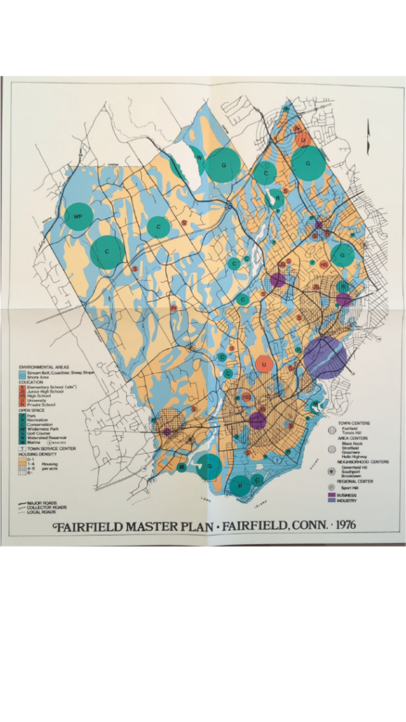
The current push to urbanize Fairfield is not merely a policy disagreement; it is a calculated erasure of the town’s own documented history. Forensic analysis of the 1976 and 1979 Master Plans – and the 1960, 1948 and 1947 Studies– reveal that the ecological collapse we face today was not only predicted but explicitly warned against by the town’s Planners. The shift from “preservation” to the modern “Commerce Drive” fabrication represents a multi-decade scheme orchestrated by distant interests, at Fairfield’s expense. Authentic Town Plans established clear mandates for neighborhoods like Tunxis — Fairfield’s recognized 2nd Town Center. For generations back to the 1800s, breadwinners have lived with their families in the “country” of Fairfield while working in Bridgeport, CT’s largest city. In addition to Tunxis, the Bridgeport-abutting chain of neighborhoods of Brooklawn, Stratfield, Melville, Toilsome Hill and Sport Hill form the town’s northeastern border. They clearly show the town’s evolution and in many regards are “true” Fairfield. It predates and belies the gold coast and affluent commuters. Today, Fairfield’s DNA is in danger of being deleted, replaced by a Transit Oriented District designed to benefit out-of-town landlords with zero interest in Fairfield’s character.
The degradation of Fairfield’s environmental integrity is best illustrated through the tangible consequences of failing to adhere to accurate data. These are not merely administrative lapses; they are the physical manifestation of a system that prioritizes development that changes code and/or ignores the facts at will.
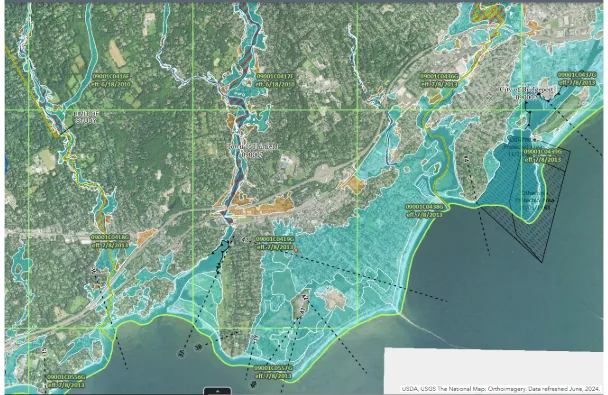
This 2013 FEMA study shows Fairfield as either in a flood zone (blue) or at severe risk (orange). There have subsequently been 12 consecutive years of rising temperatures and global sea levels are projected to rise 20 inches by 2050. Using obsolete surveys while ignoring impending environmental catastrophe in order to build is now being challenged by the CT Environmental Rights Amendment (ERA), which is up for ratification this fall.
Inland Waterways: Why Developers Cannot Fool Mother Nature
A glaring contradiction exists in the urbanization of the Route 1 corridor. While town planners fast-track high-density projects in this area, they ignore the fact that U.S. 1 is one of America’s most-famous streets, running from Maine to Florida right through Fairfield, est. 1640. And virtually all of it, from the Sasco Creek border seven miles to Ash Creek, is in a flood zone. By urbanizing this corridor, the town is creating a double liability — destroying Fairfield’s heritage while simultaneously placing residents in the path of inevitable climate disasters. These specific risks were explicitly highlighted by concerned residents during community presentations at the Osborn Hill School three years ago; yet, despite this direct public testimony, town planners proceeded with their developer-centric agenda. In fact, not only did the Town not incorporate citizens’ voracious opposition, they illicitly used them in the Plan of Conservation and Development (POCD) as an endorsement by an engaged community.
This pattern confirms that the current crisis is not a series of oversights, but a sequence of willful decisions. By prioritizing development over historical and environmental integrity, the town has abandoned its duty to protect the community’s assets, favoring developer enrichment over survival.
![Commerce Drive Evolution (2000, 2016, 2025)]](https://the-voice.com/wp-content/smush-webp/2026/06/CT-ERA-8-MetroCOG-land-use-framework-169x300.png.webp)
This map shows that like European Powers carving up Africa, Fairfield has already been designated half urban and half on the way. If you want to see a tree, visit the open space in Easton
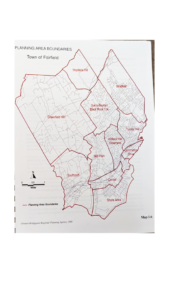
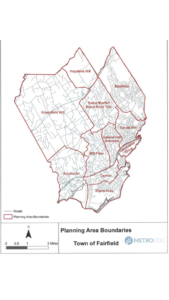
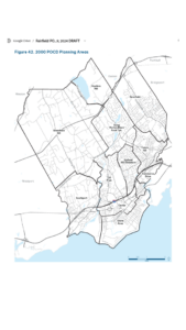
Link to 2000 Plan & Maps: https://drive.google.com/file/d/1EWsBSRdTbbhcVKmCk_HJkArbfttI1ysk/view?usp=sharing
Link to 2016 Plan & Maps: https://drive.google.com/file/d/176fQ5DQ3qaOF_mHU1-b8kLtyTmBro4eo/view?usp=sharing
Link to 2024 Plan & Maps: https://docs.google.com/document/d/1J9EDapmfd4Zv8wVKbi2ixBn3DADL4yerek1haPLN1uk/edit?usp=sharing